Most people who know me are probably already aware of this: every year I spend my holidays in the Swiss alpine village of Grindelwald. I’ve done so ever since I was quite young (at least if we agree that being four years ‘old’ is quite young). Including this summer, I’ve been going there on holidays for 30 consecutive years!
Going there every year makes Grindelwald and the surrounding area almost like a second home. This has some nice advantages: I know the location, I know that the area is (very!) nice, and (from experience) I know upfront which hikes in the area are a good or bad idea given the weather. This also means that, if for some reason I can’t do a particular hike or see a particular view (due to the weather, time constraints, my physical condition, or maybe just due to there being too many things too see in the time I’m there), I can be relaxed and happy: I’ll most likely have done that hike or seen that view in one of the previous years already, and there will be other opportunities the next years. An additional nice thing (which, admittedly, can be said about most mountainous areas) is that along a hike the perspective and view continuously changes: each step you make leads you to a new and different perspective between the mountains and the landscape nearby.
But going to the same area for 30 years also means that I get to see the landscape itself change over the years. There’s all the talk of the effects of climate change and Iceland mourning for a deceased glacier, but it’s still quite something that I actually see the glaciers in the area around Grindelwald receding at a disturbing pace. Even though it’s hard to notice individual changes from one particular year to the next, I’ve been going to the area for long enough to see that some of those changes really are dramatic changes, even in my relatively short ‘window of observation’. And even though I know and realize this, I am still shocked to realize the extent of those changes.
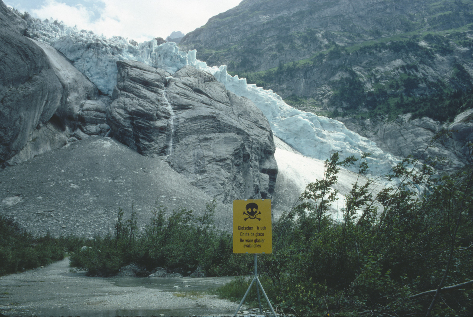
One particular instance of seeing such a change occurred this summer. My parents, my brother, and I, went to see the Steingletscher (or Steigletscher, if we’re going by the current version of swisstopo’s sometimes strange and changing nomenclature). We hadn’t been there since 2002. And while I’d already read somewhere that it had receded significantly, I was still surprised by the magnitude of the recession. My dad was so amazed that he took this as a starting point to create a series of ‘vacation cards’, featuring a photograph of the glacier he took in 2000 juxtaposed with a group photo/portrait from 2019 showing the same location with an obvious lack of that same glacier. This was the vacation card he made for me:
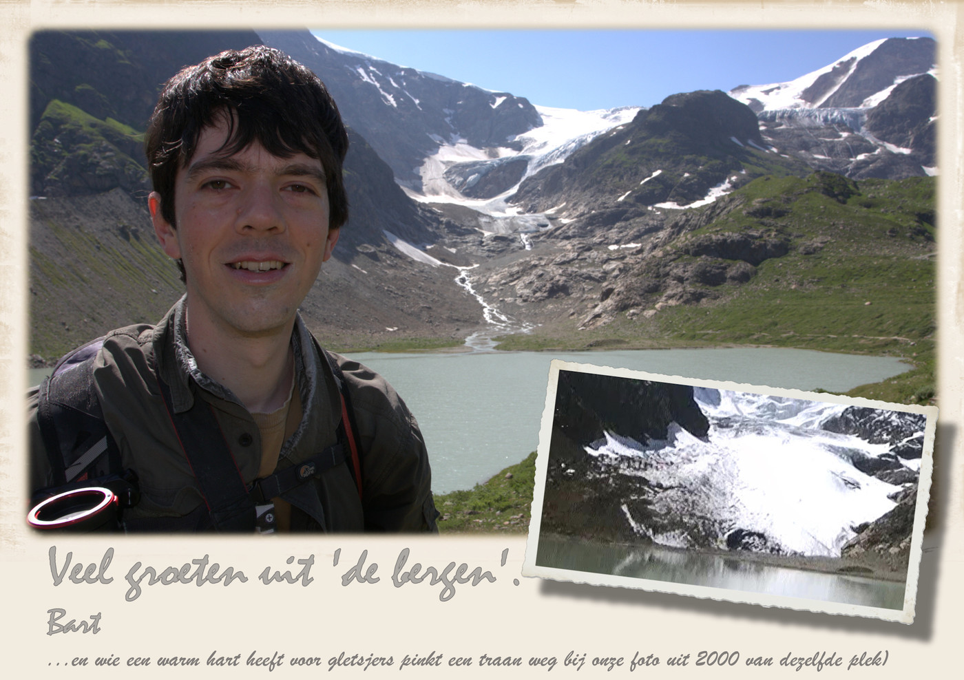
Rough translation of the Dutch text: ‘Greetings from “the mountains”. Bart (… and if you love glaciers, shed a tear for our photo from 2000 from the same spot)’. Pictures taken and arranged by my dad, Ludo Coppens.
This became the (sad) inspiration for the remainder of this post: given that I’ve been hiking in the same area for so many years, and that I’ve been taking pictures for most of that time, I was pretty sure I would be able to find some pictures from (roughly) identical locations that show the glacial recession. So I’ve scoured my collection of old pictures (mostly taken from scans of film negatives) and tried to find matching recent pictures. I’ve then tried to correct the perspective of these pictures so that they match one another as closely as possible. (For those who would like to know how: I used Hugin for this.). Given that I never intended to do this, the photographs I had to use are definitely not my best ones (a better selection of my photographs can be found here). Still, especially given that the locations/viewpoints still differ, I’m mostly pleased with how well the results turned out.
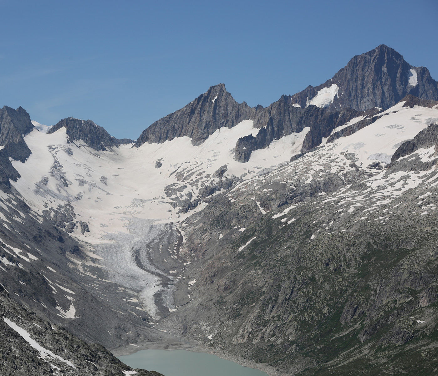
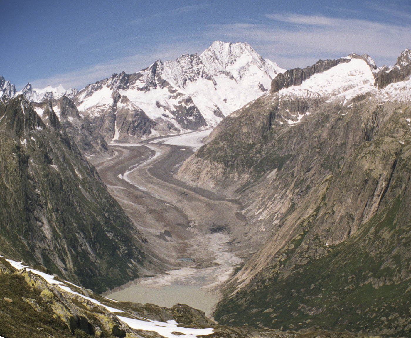
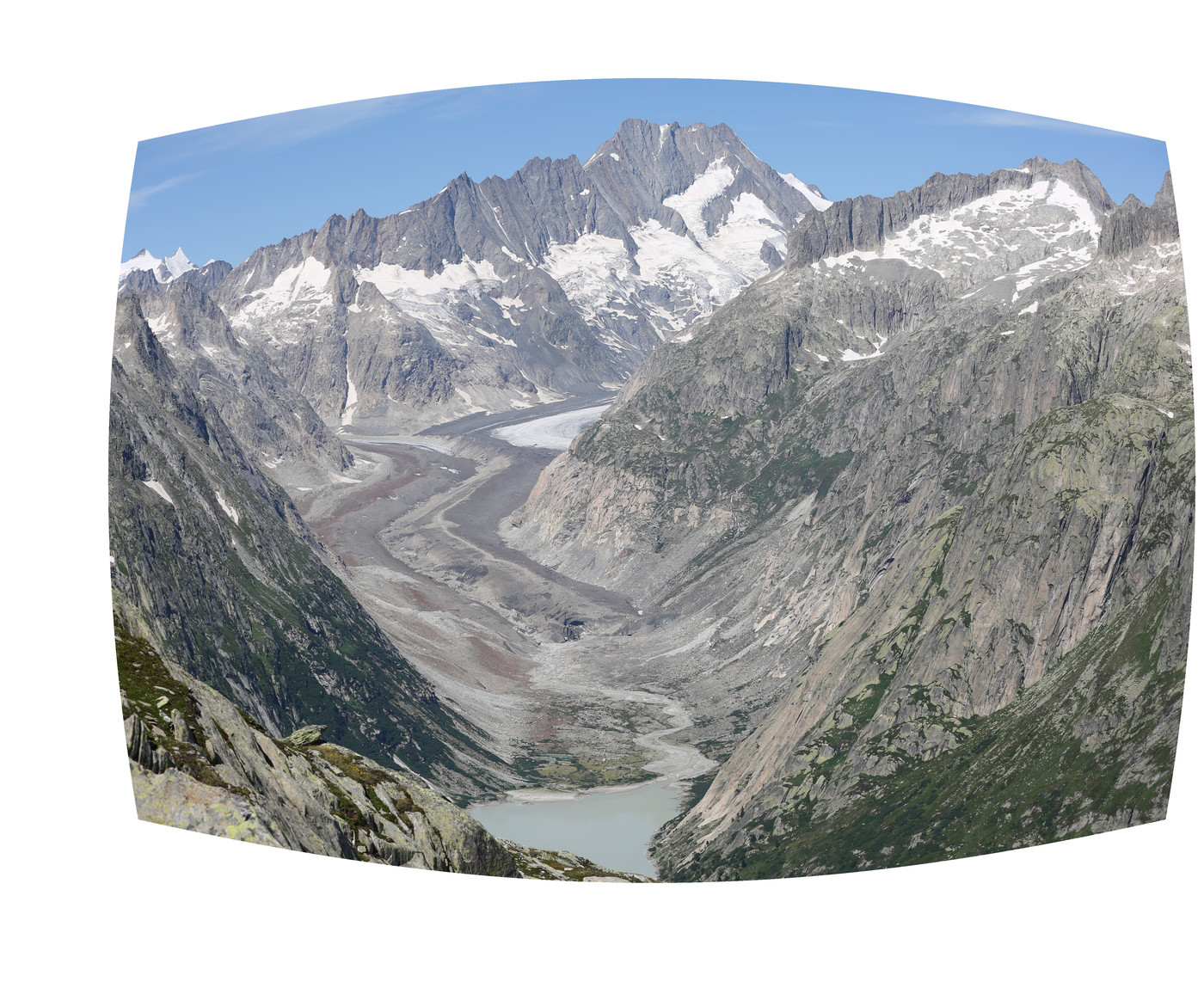
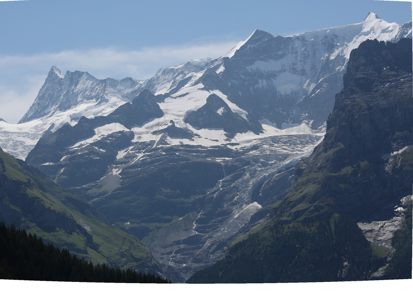
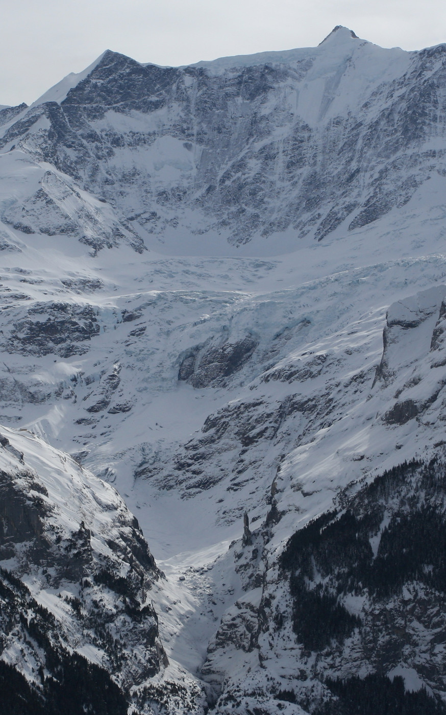
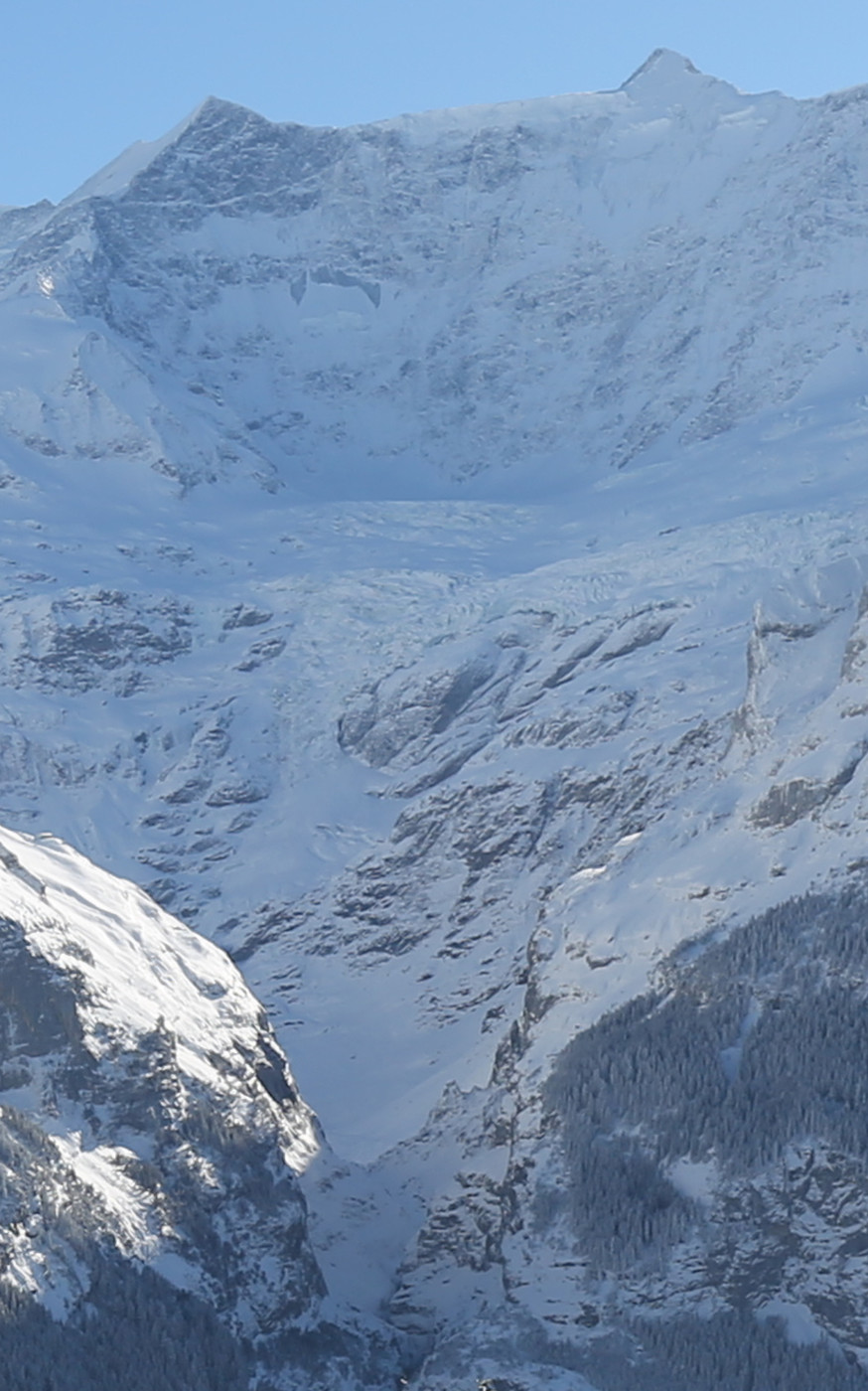
Let’s start with the instigator of this blog, and compare a picture from the Steingletscher from 1998 with one from 2019 (move the slider horizontally to compare both images; you might want to wait until all images have loaded as they are somewhat large):
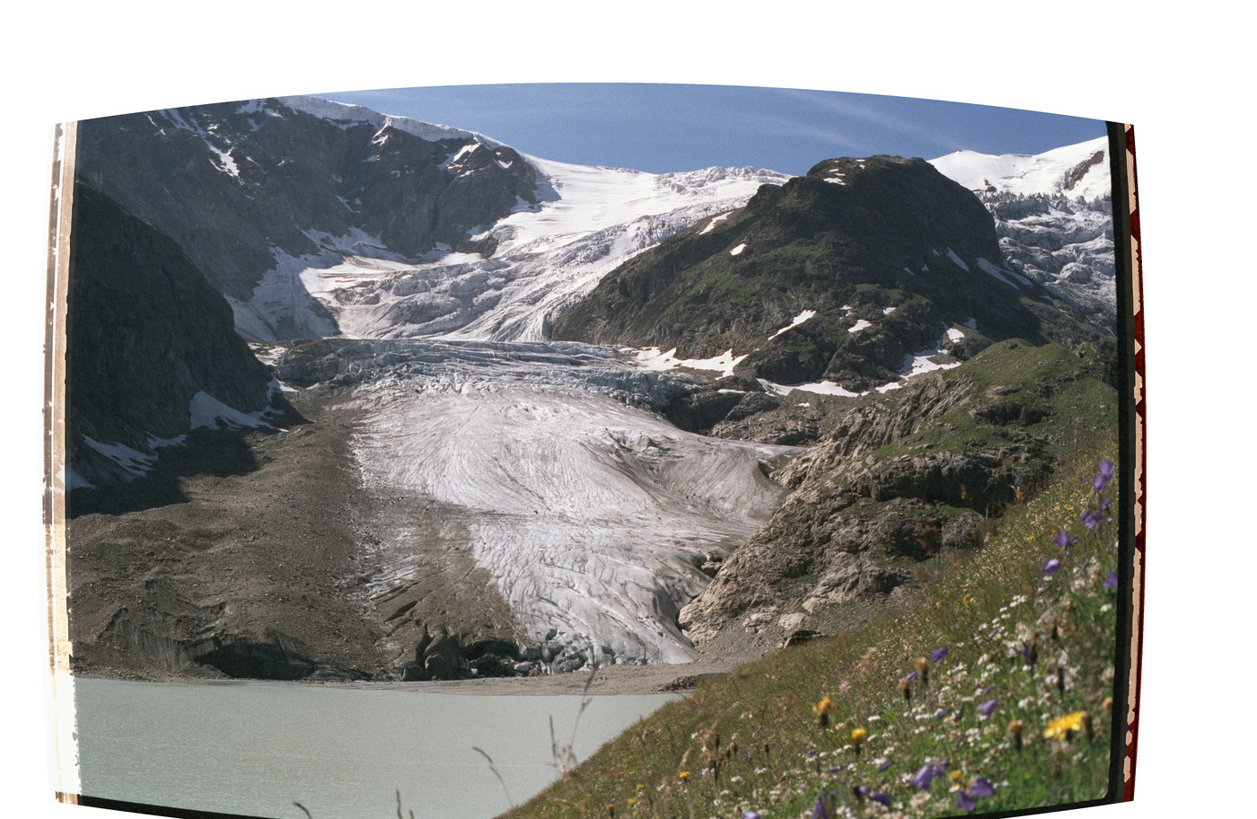
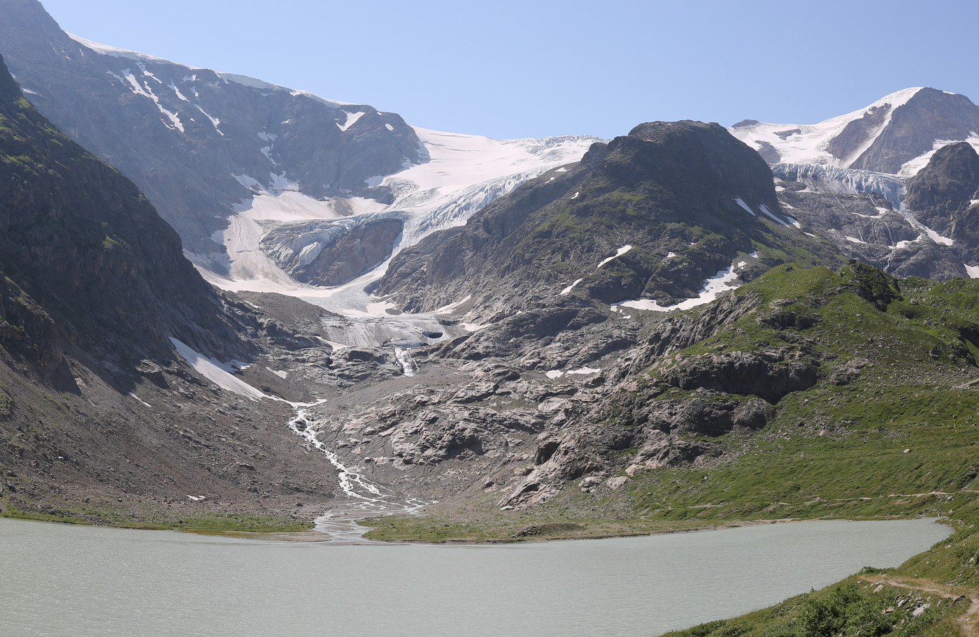
Here you can see that not only has the mouth of the glacier receded, but it has thinned significantly as well. Also note on the top right of the image how far the overhanging part of the glacier (next to Tierbergli) has vanished as well. If we have a look at the data for the Stei(n)gletscher on the site of the Schweizerische Gletschermessnetz (GLAMOS), we see that it has shrunk by 916m from 1998 to 2017. If you’re interested in seeing more clear pictures of a larger range of years, and with viewpoints that are actually stable throughout the years, both swisseduc.ch Glaciers Online and GletscherVergleiche.ch have pages with pictures of the Steingletscher: Glaciers Online’s page for the Steingletscher (which nicely shows the glacier’s extent in the ’80s and even earlier) and GletscherVergleiche’s page for the Steingletscher (which has very nice panoramic comparisons).
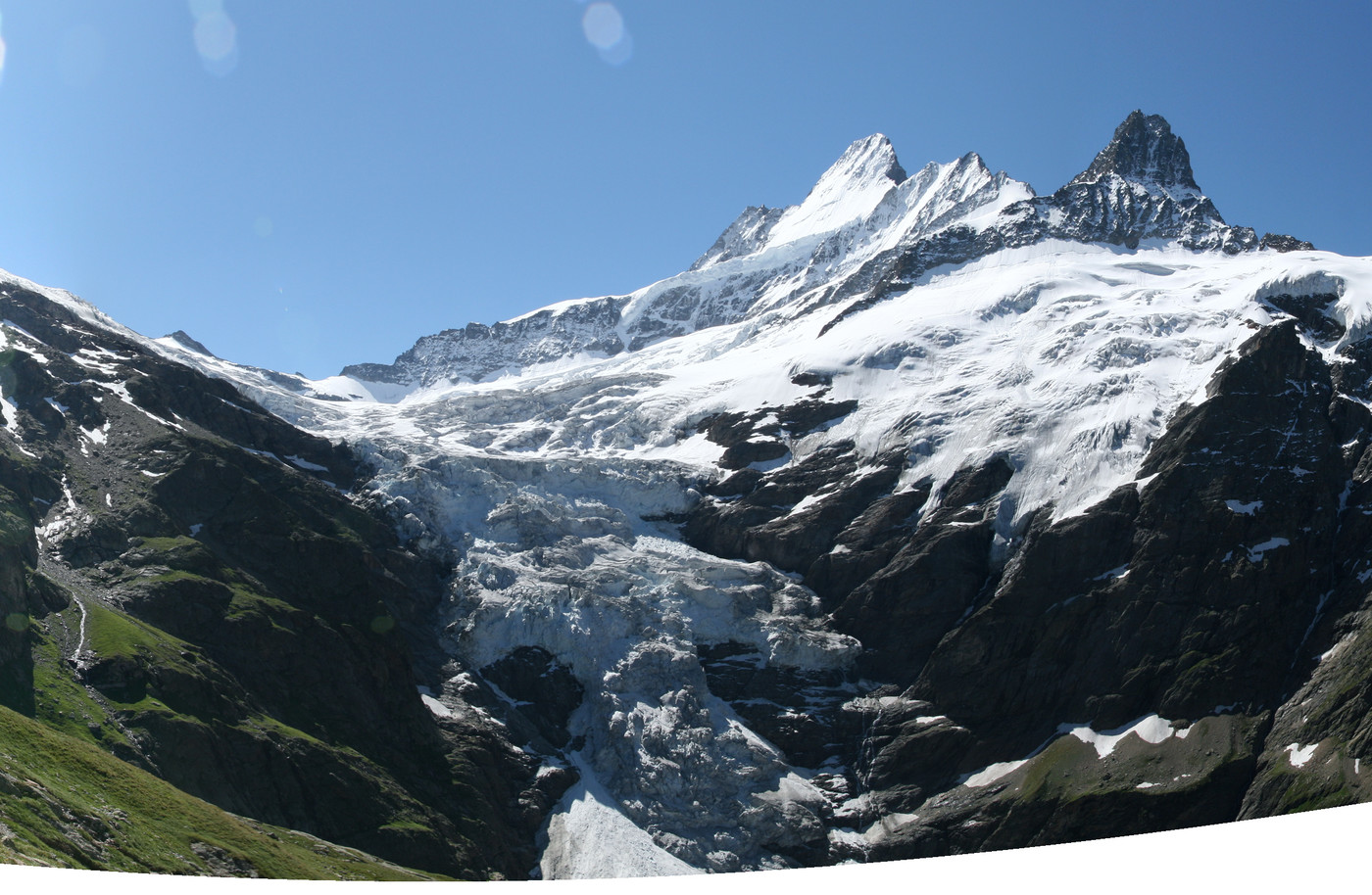
Now, the Steingletscher is not actually in Grindelwald; it’s located near the Sustenpass, which is about one hour and a half by car from Grindelwald. About an equally far drive away, near the Grimselpass, lie the Unteraargletscher and the Oberaargletscher. Let’s have a look at those before going to the glaciers in the valley of Grindelwald itself. First, let’s look at the the Oberaargletscher. The first picture is from 2003 (skipping my pictures from 2000 and 2001 of inferior quality), the second one is again from 2019:
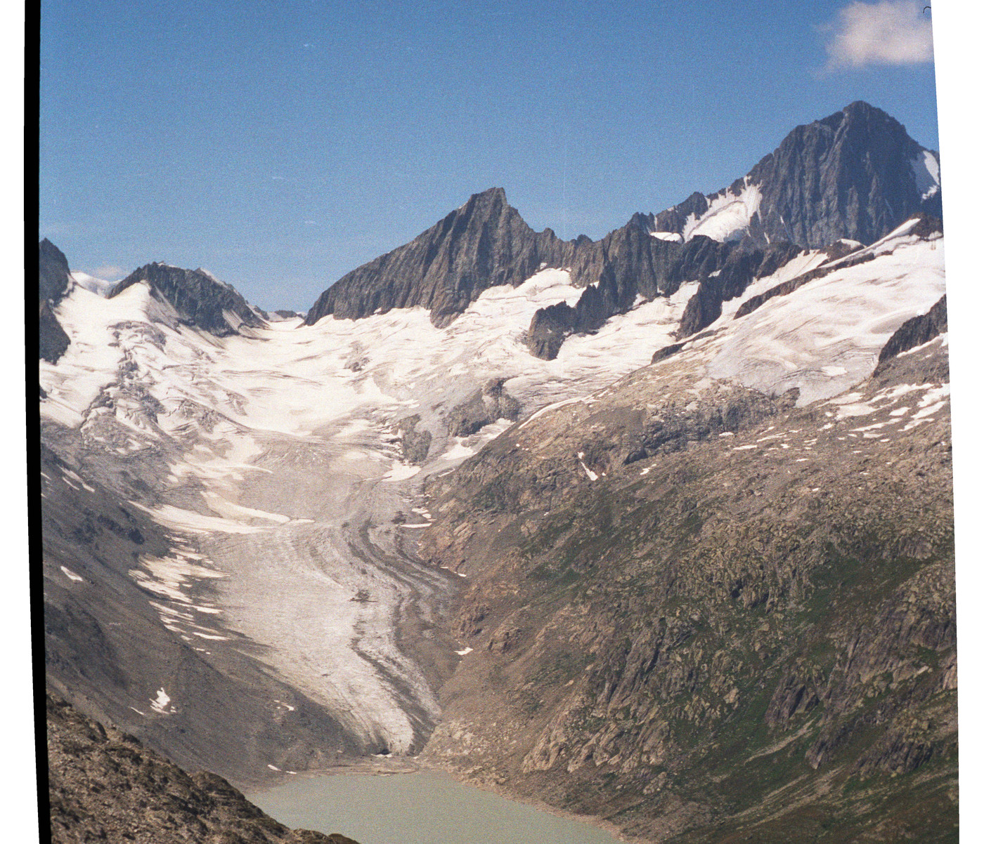
Whereas the pictures from the Steingletscher were taken from about 600 meter away from its original mouth, making the changes very obvious, the above pictures were both taken from the Sidelhorn, slightly over 6km away from the mouth of the Oberaargletscher. Still, despite the distance, you can again clearly see the decrease in length, as well as a decrease in thickness. GLAMOS has less data points, but it reports a length decrease of 143m between 2004 and 2013.
Just North of the Oberaargletscher lies the Unteraargletscher. You can compare the Unteraargletscher below, with pictures from 2000 and again from 2019:
The pattern is quite clear: again the glacier has shrunk, both in length and thickness. According to GLAMOS, this glacier shrank 399m between 2000 and 2013.
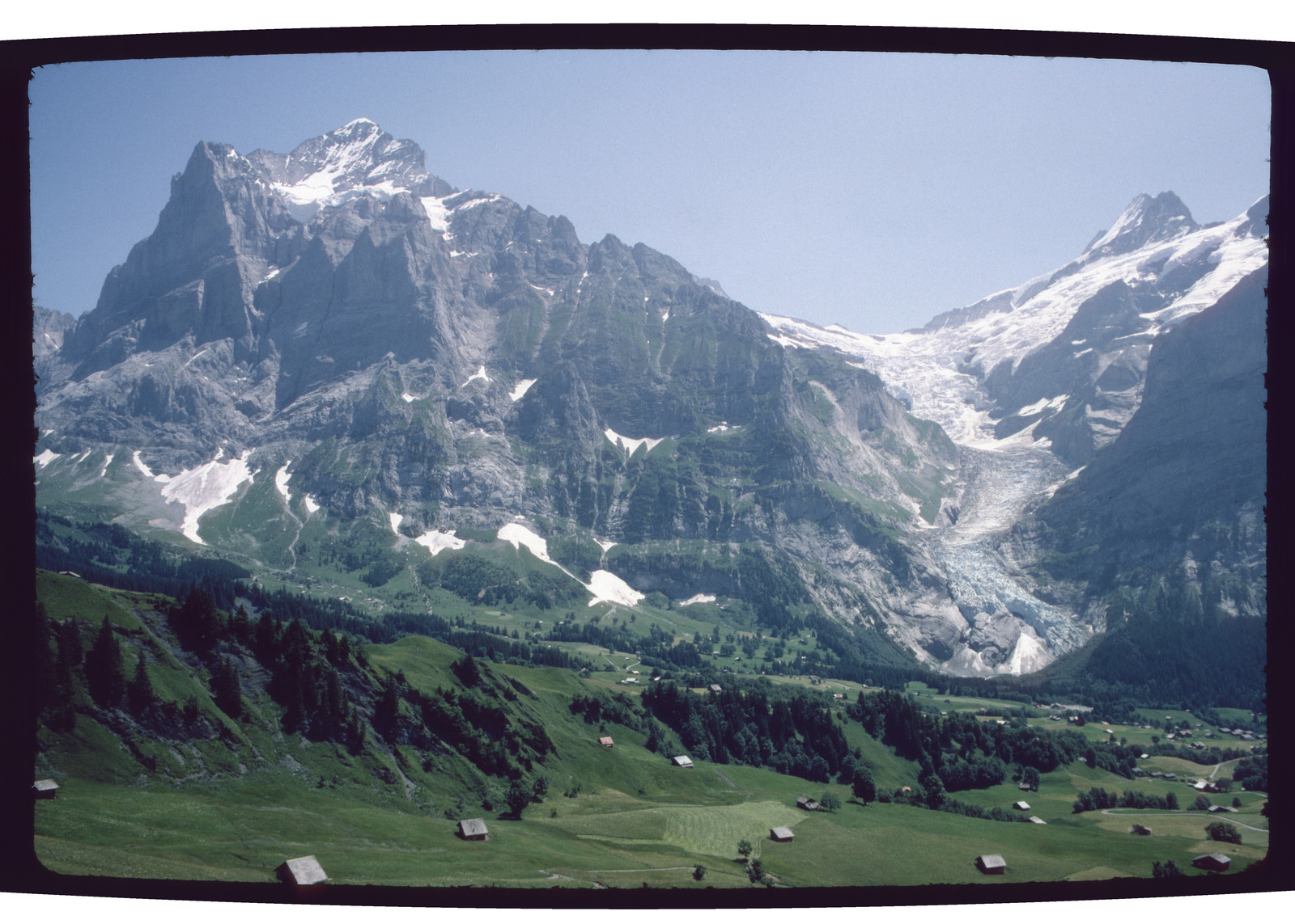
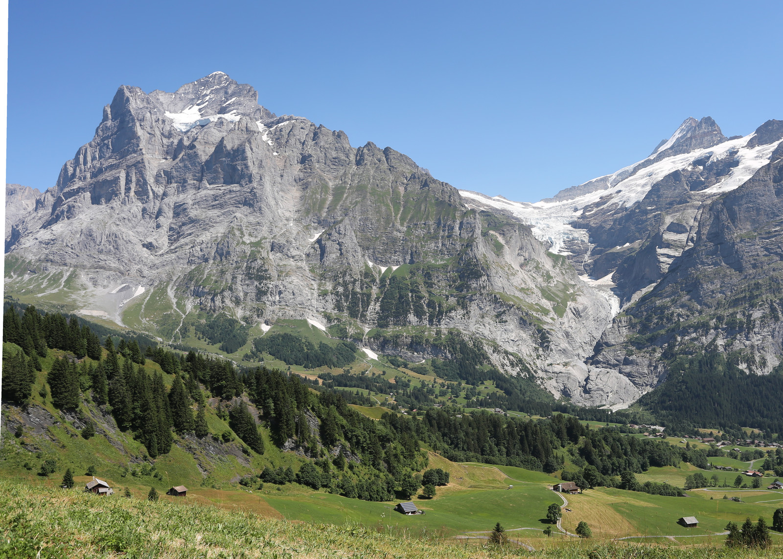
Now let’s go to Grindelwald. The first glacier we’ll look at is the Gutzgletscher, which is the hanging glacier below (the Grindelwald-facing part of) the Wetterhorn. This is actually the glacier whose retreat surprised me the most. Wherever you are in Grindelwald, you can invariably see (different sides of) this glacier, hanging at more than 3000 meter above sea level. Of the other glaciers in Grindelwald (I will get to them further down this post), I knew they were obviously, visibly, retreating. But their mouths are located at much lower altitudes. This glacier, though, seemed very stable and safe (even though I’ve sometimes seen avalanches falling off of it). And yet. Below you can see a comparison between a picture of 2008 and a picture of 2019, a mere 11 years apart:
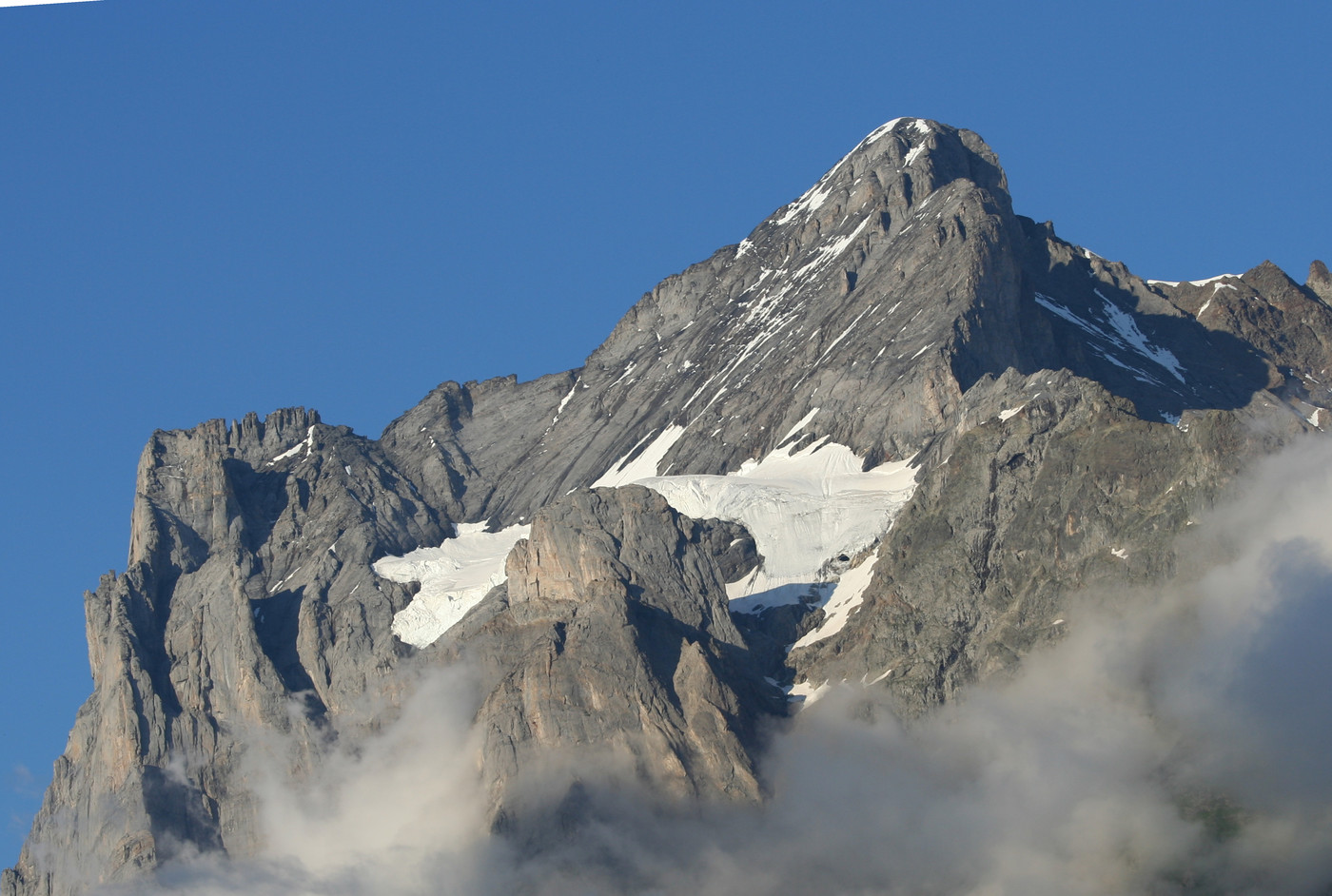
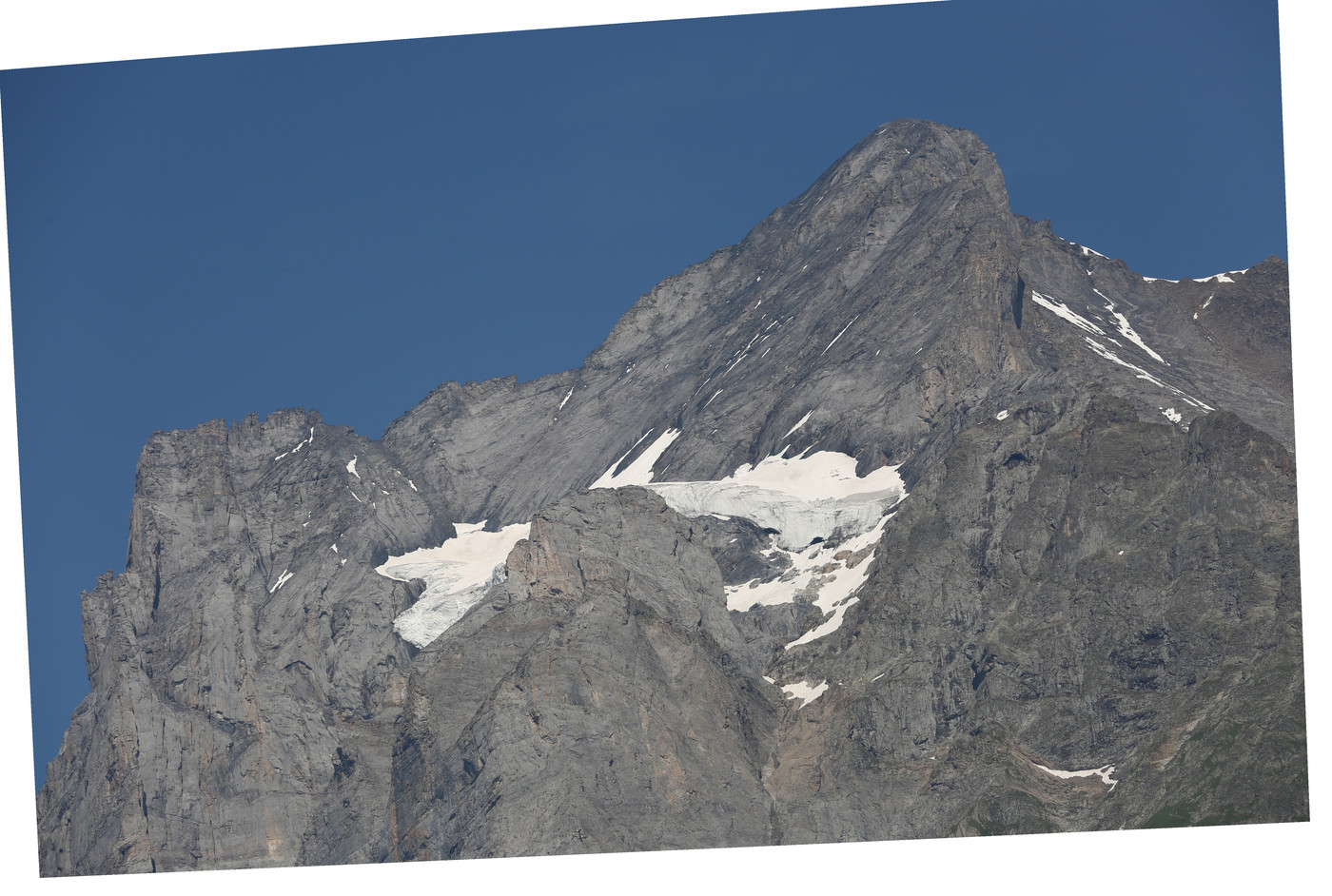
You can see not only that the mouth has retreated on the right, but also that it’s starting to thin. I had not noticed this earlier, probably because the shape itself stayed relatively constant, and the glacier is pretty far away and high up (near the rather inaccessible top of a mountain), but in photos it’s clearly visible. I don’t even know how far it has retreated, as I don’t find any measurement data. (For which I can’t blame the researchers, it really is inaccessible.)
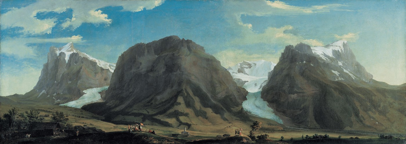
Next up are the Unterer Grindelwaldgletscher and the Oberer Grindelwaldgletscher. Those who have visited Grindelwald already will probably have noticed that some hotels and restaurants have very nice engravings or paintings from the 18th or 19th century showing scenes in Grindelwald. These feature one (or both) of these glaciers prominently, with their tongues flowing into the valley of Grindelwald. This is a scene unfamiliar to those visiting Grindelwald now: in those days the glaciers were still clearly visible from the village itself. As an example of such a painting, below is a painting from 1774 by Caspar Wolf, called Grindelwald:
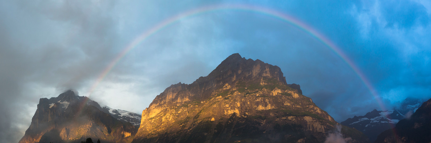
Now, I obviously don’t have such a wide panoramic image from the same vantage point, but I do have something from 2019 that covers the left half of that painting (even though the perspective is completely different and the atmospheric conditions are rather different, but for even nicer atmospheric conditions, I have this photograph of the Wetterhorn and Mättenberg with a rainbow from 2018):
At the left in both pictures you can see the Wetterhorn (which you might recognize in the meantime from the picture of the Gutzgletscher above). The mountain next to the Wetterhorn is the Mättenberg, and in between the Wetterhorn and the Mättenberg lies the Oberer Grindelwaldgletscher. In the painting it spills out of the valley between both mountains, whereas in my picture you can’t see it anymore. Right of the Mättenberg lies the Eiger, but my photograph unfortunately cuts out right at the beginning (at Ostegg). The rightmost valley in the painting is with the very pretty glacier called Unterer Grindelwaldgletscher. It is conspicuously absent from my photograph.
Now, admittedly, those glaciers have been melting and retreating for quite a while (we don’t live in the little ice age anymore, it seems). So even when I was young, they did not come as far into the valley as in the painting. Even so, the remaining parts have retreated very rapidly and at an accelerating pace the past couple of decades, during my lifetime.
Here, however, I run into trouble with my pictures. As I mentioned earlier, the perspective constantly shifts during hikes. So unfortunately the perspective of all my pictures varies significantly, even though the subject is (roughly) the same. I could get away with that for the previous glaciers because they’re obvious points of interest of certain locations (such as from a mountain peak, or from my hotel). Similarly, conditions (clouds, haze, lighting, …) vary significantly from year to year for the same views. Again, I could get away with that in the previous pictures because those are taken on hikes we typically only with nice weather, but not so for pictures taken of the glaciers inside of Grindelwald. Now, I do take lots of random snapshots on these hikes, so I have a huge amount of pictures from over the years, all from different perspectives. This just makes the (combinatorial) problem harder, just try finding even a single decent matching pair in that mass of different pictures. A final complication is that the best views of these two glaciers are offered from the Glecksteinhütte (for the Oberer Grindelwaldgletscher), and the Berghaus Bäregg or previously the Stieregghütte (for the Unterer Grindelwaldgletscher). This is problematic because both my dad and I have some fear of heights. So I’ve been to the Stieregghütte only once in 2001 (my dad thinks I’ve been there twice, actually, but I can’t remember or find any pictures of this second instance), and not at all to the Glecksteinhütte. I would still like to visit them once (again), though, if only to see what has become of the glaciers from those points of view.
So, given those constraints above, the ‘best’ I could do for the Unterer Grindelwaldgletscher is the following pair of images, from 2006 and 2019:

According to GLAMOS, this glacier shrunk 1308m between 2013 and 2017 (yes, that’s massive: 1.3 kilometer in only four years). In the picture from 2006 you can still very clearly see a rather thick portion of the glacier that extends up until almost the bottom of the picture. In contrast, in the picture from 2019 that’s almost entirely gone. Furthermore, given the very sad photographs from both Glaciers Online and GletscherVergleiche and having a look at swisstopo’s map of the area it’s not clear to me how much of this glacier still remains / will remain in the coming years (its original tributaries definitely still exist for now, though).
There is an alarming side effect of a retreating glacier such as the Unterer Grindelwaldgletscher. Whereas the ice used to exert pressure against the valley walls, that pressure is now gone, together with the glacier itself. This results in instability in the moraines and the rocks surrounding the glacial valleys. The most obvious effect on this particular location is the Stieregghütte I talked about visiting in 2001: it not longer exists, as the moraine on which it was built became unstable and slipped away in 2005, taking the hut with it. This can be seen on the site of Berghaus Bäregg. A year later, in 2006, on the opposing side of the narrow valley, a rather large piece of the mountain itself collapsed. While I don’t have pictures of the event that are as impressive as Glaciers Online’s, the following pictures show a bit of the after-effects:
The left picture from February 2009 shows at the right bottom side a piece of rock that has detached from the mountain, but still has some semblance of being upright, whereas the picture from February 2019 shows how it too has collapsed. Finally, these collapsing moraines and mountain sides are not only pretty dangerous for those that would happen to be in the area, they can also dam water flows, causing glacial lakes (more info of these events in Grindelwald can be found both at Glaciers Online and at this specific glacier lake’s own website) and associated floodings.
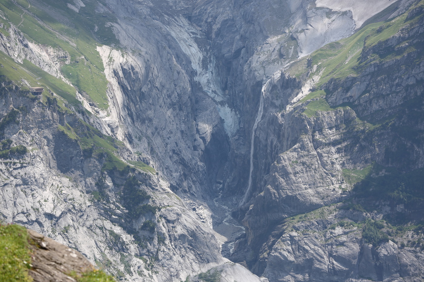
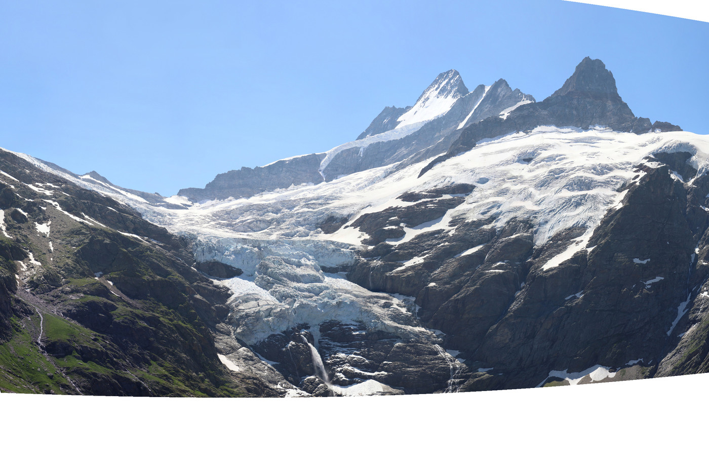
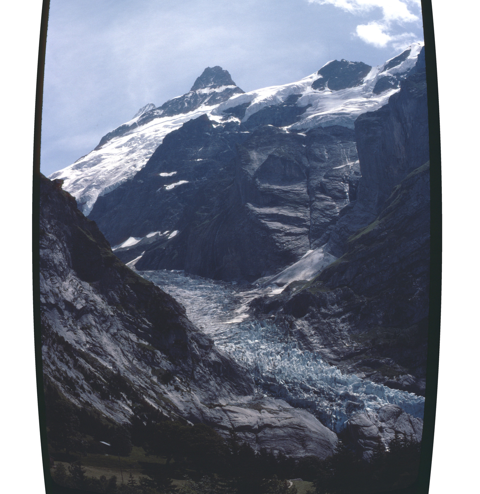
Finally then, Grindelwald has the Oberer Grindelwaldgletscher. Better photos would be taken from the hike to the Glecksteinhütte, (or from the other side of Grindelwald, with a telephoto lens), but I have to make do with these pictures from the side (taken slightly below a location called Sibet Schirli/7. Schürli) from 2008 and 2019:
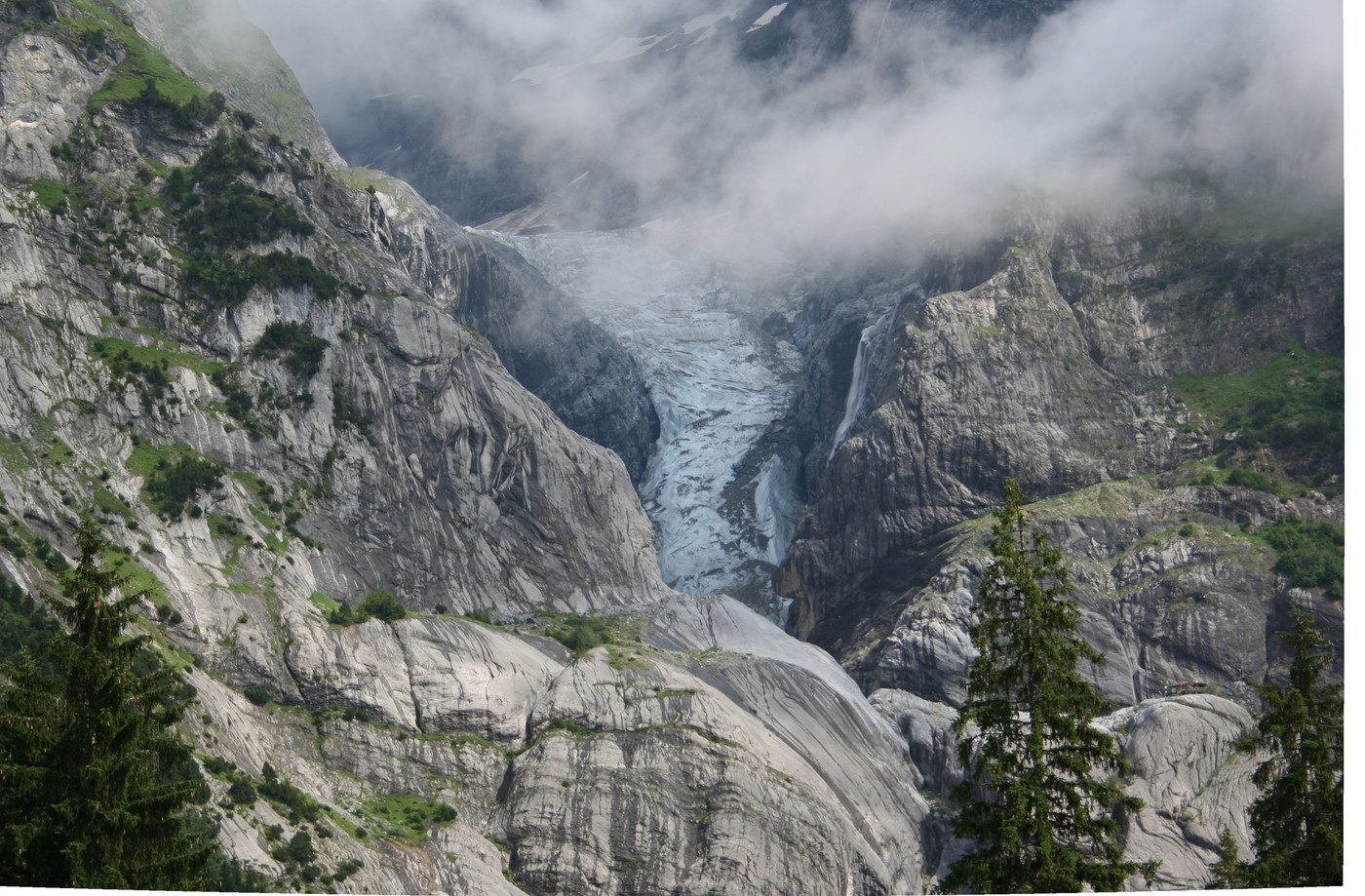
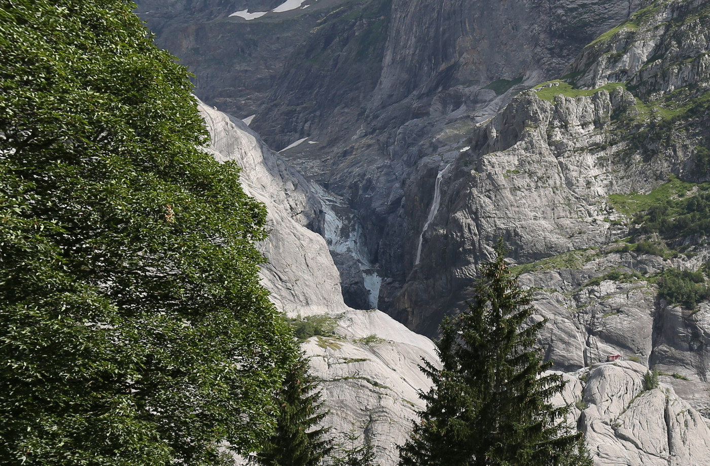
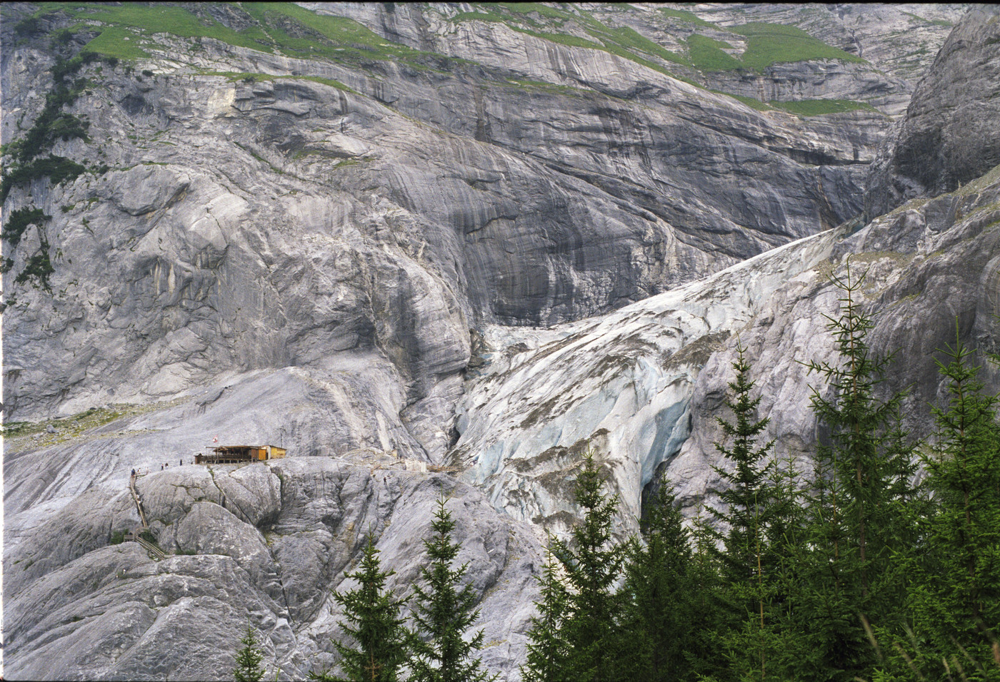
This already looks quite bad. According to GLAMOS, it receded 325.3m between 2009 and 2017. But of course it’s receded much more during my lifetime. If you look closely on the lower right side of both pictures, you might be able to see a small cabin standing on the rock there. At that spot, there used to be a small tourist attraction: you could take stairs from the valley floor up to the cabin, and then right next to it walk on the glacier itself (or inside the glacier: they had made a small ice cave). I went up there in 1997, but for some reason I don’t have any (decent) pictures of it myself. Still, the picture below (taken on the way to Milchbach, a café somewhat further on) shows that cabin next to the glacier’s tongue in 1998:
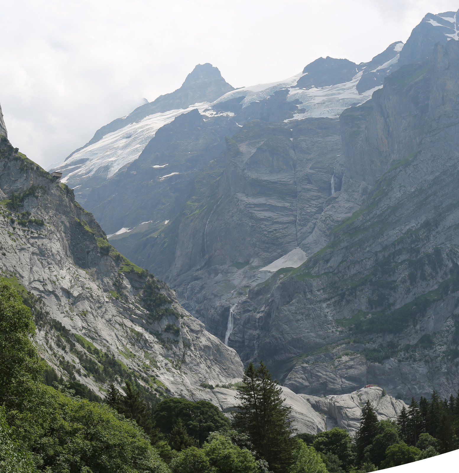
My dad (who first visited Grindelwald in 1970) tells me that he remembers the ice being much thicker over there as well, even covering the spot where that cabin was put. And that’s all gone now. A picture from 2019 from the other side of the Grindelwald valley, to contrast with the picture above:
Compare and contrast the locations of the glacier in the picture above with the pictures from 1998 and 2008. In the above picture, the cabin is quite a bit outside the frame (in the direction downwards and to the right).
Finally, even though I myself never went to the Glecksteinhütte, my brother, Bruno Coppens, already did so on multiple occasions. I got his permission to use some of his photographs, and try and make a comparison as well. I was able to make the following comparison, which is the view from the Glecksteinhütte to the South, to (part of) the top of the Oberer Grindelwaldgletscher:
Even at these altitudes, (‘still’) relatively far away from the mouth, the glacier is becoming significantly reduced in size. So I really should hike to the Glecksteinhütte and see that view for myself, before it ceases to exist…
With that, I conclude my comparison of pictures of glaciers in the (surroundings of) the Grindelwald area, for now. I hope some of you found it interesting (if not sad/depressing).
I might, in the future, update this post if either I find better viewpoints in my existing collection of photographs, or if I would take new photographs that would better match earlier ones.
Update 2019-11-18
My dad was quite enthusiastic about the comparisons above, and offered to have a look at his collection of color slides to see if he couldn’t find some older pictures of the Unterer and Oberer Grindelwaldgletscher so I could try and make better comparisons. Luckily, he was able to find some slides of the Oberer Grindelwaldgletscher that I could match against recent pictures. Even though these slides were taken a few years before I was born, I still decided to include these here, because they show even more clearly the dramatic changes in a relatively short period of time.
First, a view of the Oberer Grindelwaldgletscher that might be familiar from earlier: both of these pictures were taken near 7. Schürli, the first one was taken by my dad in 1979 (when there was even no cabin), the second one was taken by me in 2019:
In the picture from 1979 you can see how the glacier really still looked like a river of ice. You can clearly see the reduction in length (802.3m between 1979 and 2017 according to GLAMOS). This comparison also starts giving an impression of just how much mass of ice was lost in those 40 years.
The second set of pictures, from an entirely different point of view a little bit below the Bort cable car station, makes this loss of ice mass even more clear. The first picture is taken in 1982 by my dad, the second one was taken in 2015 by me:
The first thing you’ll clearly see, is just how much less prominent the glacier has become in the overall landscape. Next, not only the reduction in length becomes apparent, but also the mass reduction I mentioned above. You don’t only see this because of the places where the glacier is now entirely gone, but also more near the top, the reduced thickness is alarming.
As a final picture, my dad also has a picture of the mouth of the Oberer Grindelwaldgletscher from near its mouth in 1982:
Update history
2019-11-07: Original publication
2019-11-17: Rewrote some sentences to enhance clarity and readability
2019-11-18: Added more comparisons of the Oberer Grindelwaldgletscher with pictures from my dad